Պատկեր:Louisiade archipelago.jpg

Նախադիտման չափ՝ 800 × 600 պիքսել։ Այլ թույլտվությաններ: 320 × 240 պիքսել | 640 × 480 պիքսել | 1024 × 768 պիքսել | 1280 × 960 պիքսել | 2000 × 1500 պիքսել.
Սկզբնական նիշք (2000 × 1500 փիքսել, նիշքի չափը՝ 449 ԿԲ, MIME-տեսակը՝ image/jpeg)
Ամփոփում
| Նկարագրում |
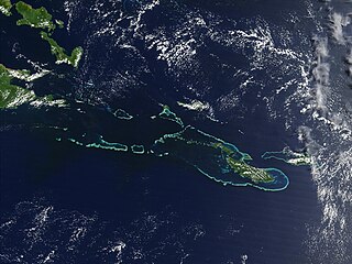
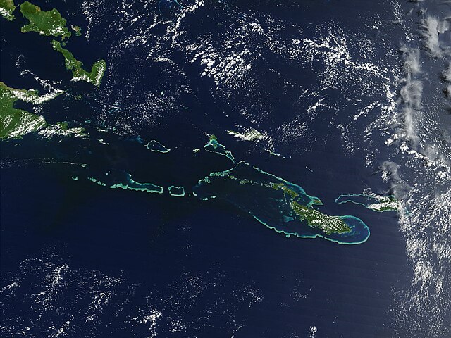
English: Off the southeast tip of Papua New Guinea lies a string of small volcanic islands and coral reefs collectively called the Louisiade Archipelago. This true-color MODIS image from September 11, 2002, is centered on the island chain, with Papua New Guinea at the left edge. Moving westward from eastern end of the chain are the islands of Rossel and Tagula. (Misima Island, which harbors the largest village in the region, is obscured by a patch of clouds northeast of image center.) To the north of the chain lies the Solomon Sea, and to the south is the Coral Sea. Most of the undisturbed land is covered by tropical rainforest, and despite their small size, the islands harbor a number of plant and animal species found nowhere else. |
| Թվական | 7 Մայիս 2005 (original upload date) |
| Աղբյուր | Transferred from en.wikipedia |
| Հեղինակ | NASA |
Արտոնագրում
| Այս նիշքը հանրության սեփականության է պատկանում, քանզի այն ստեղծվել է ՆԱՍԱ-ն։ ՆԱՍԱ-ի հեղինակային իրավունքների մասին քաղաքականությունը նշում է, որ «ՆԱՍԱ-ի նյութերը հեղինակային իրավունքներով պաշտպանված չեն, միթե այդպես նշված լինի»։ (Տե՛ս Template:PD-USGov, ՆԱՍԱ-ի հեղինակային իրավունքների քաղաքականության մասին էջը կամ ՋեյՓիԷլի պատկերների օգտագործման մասին քաղաքականությունը)։ | ||
 |
Զգուշացումներ՝:
|
Original upload log
All following user names refer to en.wikipedia.
- 2005-05-07 02:55 PDH 2000×1500× (459961 bytes) Off the southeast tip of Papua New Guinea lies a string of small volcanic islands and coral reefs collectively called the Louisiade Archipelago. This true-color MODIS image from September 11, 2002, is centered on the island chain, with Papua New Guinea at
Նիշքի պատմություն
Մատնահարեք օրվան/ժամին՝ նիշքի այդ պահին տեսքը դիտելու համար։
| Օր/Ժամ | Մանրապատկեր | Օբյեկտի չափը | Մասնակից | Մեկնաբանություն | |
|---|---|---|---|---|---|
| ընթացիկ | 08:55, 18 Հոկտեմբերի 2009 | | 2000 × 1500 (449 ԿԲ) | Urdangaray | {{Information |Description={{en|Off the southeast tip of Papua New Guinea lies a string of small volcanic islands and coral reefs collectively called the Louisiade Archipelago. This true-color MODIS image from September 11, 2002, is centered on the island |
Նիշքի օգտագործում
Հետևյալ էջը հղվում է այս նիշքին՝
Նիշքի համընդհանուր օգտագործում
Հետևյալ այլ վիքիները օգտագործում են այս նիշքը՝
- Օգտագործումը als.wikipedia.org կայքում
- Օգտագործումը ast.wikipedia.org կայքում
- Օգտագործումը br.wikipedia.org կայքում
- Օգտագործումը ca.wikipedia.org կայքում
- Օգտագործումը ceb.wikipedia.org կայքում
- Օգտագործումը de.wikipedia.org կայքում
- Օգտագործումը en.wikipedia.org կայքում
- Օգտագործումը en.wikivoyage.org կայքում
- Օգտագործումը eo.wikipedia.org կայքում
- Օգտագործումը es.wikipedia.org կայքում
- Օգտագործումը eu.wikipedia.org կայքում
- Օգտագործումը he.wikivoyage.org կայքում
- Օգտագործումը it.wikipedia.org կայքում
- Օգտագործումը it.wikivoyage.org կայքում
- Օգտագործումը ka.wikipedia.org կայքում
- Օգտագործումը la.wikipedia.org կայքում
- Օգտագործումը or.wikipedia.org կայքում
- Օգտագործումը pl.wikipedia.org կայքում
- Օգտագործումը vi.wikipedia.org կայքում
- Օգտագործումը www.wikidata.org կայքում