Պատկեր:Dufourspitze from east.jpg
Նախադիտման չափ՝ 800 × 595 պիքսել։ Այլ թույլտվությաններ: 320 × 238 պիքսել | 640 × 476 պիքսել | 1024 × 761 պիքսել | 1080 × 803 պիքսել.
Սկզբնական նիշք (1080 × 803 փիքսել, նիշքի չափը՝ 226 ԿԲ, MIME-տեսակը՝ image/jpeg)
Ամփոփում
| Նկարագրում |
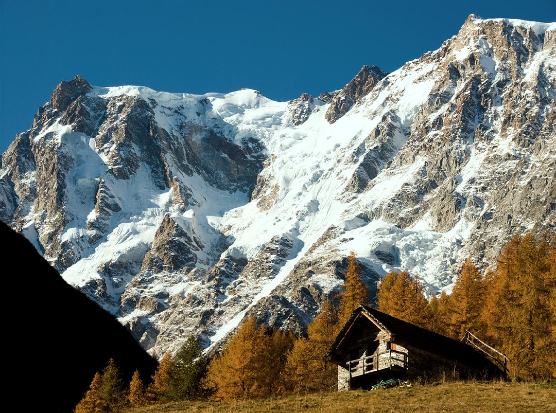
English: The 2.5 km high eastern wall of the Dufourspitze (4634 metres, 15 200 feet). The true summit lies in the middle right, between the Signalkuppe (4554 metres) on the left and the Nordend (4609 metres) on the right. |
| Թվական | |
| Աղբյուր | Բեռնողի սեփական աշխատանք |
| Հեղինակ | Alagna |
Արտոնագրում
| I, the copyright holder of this work, release this work into the public domain. This applies worldwide. In some countries this may not be legally possible; if so: I grant anyone the right to use this work for any purpose, without any conditions, unless such conditions are required by law. |
| Annotations | This image is annotated: View the annotations at Commons |
Նիշքի պատմություն
Մատնահարեք օրվան/ժամին՝ նիշքի այդ պահին տեսքը դիտելու համար։
| Օր/Ժամ | Մանրապատկեր | Օբյեկտի չափը | Մասնակից | Մեկնաբանություն | |
|---|---|---|---|---|---|
| ընթացիկ | 16:56, 12 Մարտի 2009 | | 1080 × 803 (226 ԿԲ) | Alagna | {{Information |Description={{en|1=The 2.5 km high eastern wall of the Dufourspitze (4634 metres, 15 200 feet). The true summit lies in the middle right, between the Signalkuppe (4554 metres) on the left and the Nordend (4609 metres) on the right.}} |Sourc |
Նիշքի օգտագործում
Հետևյալ էջը հղվում է այս նիշքին՝
Նիշքի համընդհանուր օգտագործում
Հետևյալ այլ վիքիները օգտագործում են այս նիշքը՝
- Օգտագործումը bg.wikipedia.org կայքում
- Օգտագործումը cs.wikipedia.org կայքում
- Օգտագործումը en.wikipedia.org կայքում
- Օգտագործումը eo.wikipedia.org կայքում
- Օգտագործումը es.wikipedia.org կայքում
- Օգտագործումը et.wikipedia.org կայքում
- Օգտագործումը it.wikipedia.org կայքում
- Օգտագործումը nn.wikipedia.org կայքում
- Օգտագործումը no.wikipedia.org կայքում
- Օգտագործումը ru.wikipedia.org կայքում
- Օգտագործումը sl.wikipedia.org կայքում
- Օգտագործումը sv.wikipedia.org կայքում