Պատկեր:Solomon Islands adm location map.svg

Սկզբնական նիշք (SVG-նիշք, անվանապես 1890 × 1097 փիքսել, նիշքի չափը՝ 148 ԿԲ)
Ամփոփում
| Նկարագրում |
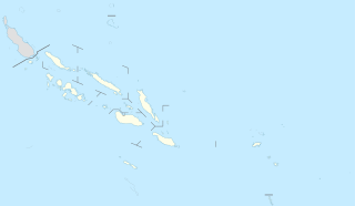
Deutsch: Positionskarte der Salomonen
English: Location map of the Solomon Islands
|
||||||||||||
| Թվական | |||||||||||||
| Աղբյուր |
Own work using:
|
||||||||||||
| Հեղինակ | NordNordWest | ||||||||||||

|
Այս քարտեզը բարելավված է եղել գերմանական Kartenwerkstatt-ում: Դուք կարող եք նաև առաջարկել այլ քարտեզներ դրանց բարելավման համար:
|
Արտոնագրում
Usage of this file with:

explanatory notes: Legally binding is only the full legalcode. For a free usage I recommend to respect the following licence conditions:
1. Provide my name as given above: NordNordWest,
2. a copy of, or the URI for, the applicable license: https://creativecommons.org/licenses/by-sa/3.0/de/legalcode,
3. the title of the work,
4. in the case of an adaptation, a credit identifying the use of the work in the adaptation.
This license and the rights granted hereunder will terminate automatically upon any breach by you of the terms of this license. Any of the above conditions can be waived if you get permission from the copyright holder. If you have questions or wish differing conditions, please contact me through nnwest or my discussion page ![]() t-online.de
t-online.de
- Դուք ազատ եք՝
- կիսվել ստեղծագործությամբ – պատճենել, տարածել և փոխանցել այս աշխատանքը։
- վերափոխել – ադապտացնել աշխատանքը
- Պահպանելով հետևյալ պայմանները'
- հղում – Դուք պետք է նշեք հեղինակի (իրավատիրոջ) հղումը:
- համանման տարածում – Եթե դուք ձևափոխում եք, փոխակերպում, կամ այս աշխատանքի հիման վրա ստեղծում եք նոր աշխատանք, ապա ձեր ստեղծածը կարող է տարածվել միայն նույն կամ համարժեք թույլատրագրով։

Նիշքի պատմություն
Մատնահարեք օրվան/ժամին՝ նիշքի այդ պահին տեսքը դիտելու համար։
| Օր/Ժամ | Մանրապատկեր | Օբյեկտի չափը | Մասնակից | Մեկնաբանություն | |
|---|---|---|---|---|---|
| ընթացիկ | 16:54, 20 Նոյեմբերի 2020 | | 1890 × 1097 (148 ԿԲ) | NordNordWest | corr |
| 18:36, 15 Մարտի 2017 |  | 1890 × 1097 (147 ԿԲ) | NordNordWest | == {{int:filedesc}} == {{Information |Description= {{de|1=Positionskarte der Salomonen}} {{en|1=Location map of the Solomon Islands}} {{Location map series N |stretching=101 |top=-4.3 |bottom=-13.5 |left=154.4 |right=170.4 }} |Source={{Own using}} * Un... |
Նիշքի օգտագործում
Այս նիշքին օգտագործող էջեր չկան։
Նիշքի համընդհանուր օգտագործում
Հետևյալ այլ վիքիները օգտագործում են այս նիշքը՝
- Օգտագործումը ast.wikipedia.org կայքում
- Ḥoniara
- Módulu:Mapa de llocalización/datos/Islles Salomón
- Módulu:Mapa de llocalización/datos/Islles Salomón/usu
- Makira
- Kirakira
- Islles Florida
- Islles Nueva Xeorxa
- Vangunu
- Islla de Rennell
- Kolombangara
- Golfu de Kula
- Llaguna de Marovo
- Ranongga
- Nggatokae
- Simbo
- Islles Arnarvon
- Islla Bellona
- Islla de Ghizo
- Islles Duff
- Islla Malaita
- Islla de Savo
- Gavutu
- Islla Kennedy
- Islles Reef
- Islla Choiseul
- Vella Lavella
- Islla Nueva Xeorxa
- Tinakula
- Islla Furona
- Islla de Santa Isabel
- Malaita Sur
- Islla Nendö
- Taumako
- Rennell Este
- Islles Santa Cruz
- Tulagi
- Islla Fera
- Fatutaka
- Anuta
- Tikopia
- Pavuvu
- Utupua
- Օգտագործումը bn.wikipedia.org կայքում
- Օգտագործումը de.wikipedia.org կայքում
Տեսնել այս նիշքի ավելի համընդհանուր օգտագործումը: