Պատկեր:Raismes - Église Sainte-Barbe de Vicoigne (B).JPG

Նախադիտման չափ՝ 450 × 600 պիքսել։ Այլ թույլտվությաններ: 180 × 240 պիքսել | 360 × 480 պիքսել | 576 × 768 պիքսել | 768 × 1024 պիքսել | 1536 × 2048 պիքսել | 2736 × 3648 պիքսել.
Սկզբնական նիշք (2736 × 3648 փիքսել, նիշքի չափը՝ 3,45 ՄԲ, MIME-տեսակը՝ image/jpeg)
Ամփոփում
| Նկարագրում |
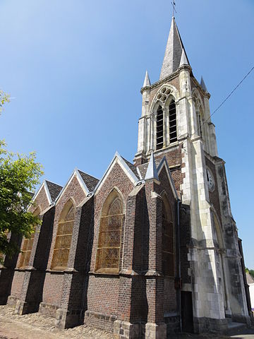
Français : Église Sainte-Barbe et presbytère de la Compagnie des mines de Vicoigne dans le bassin minier du Nord-Pas-de-Calais, hameau de Vicoigne, Raismes, Nord, Nord-Pas-de-Calais, France. |
|||||||
| Թվական | ||||||||
| Աղբյուր | Բեռնողի սեփական աշխատանք | |||||||
| Հեղինակ | Jérémy Jännick | |||||||
| Իրավունքներ (Նիշքի վերաօգտագործումը) |
| |||||||
| Հղում (required by the license) | Jérémy-Günther-Heinz Jähnick / Raismes - Église Sainte-Barbe de Vicoigne (B) / Wikimedia Commons / | |||||||

.JPG)
| Տեսախցիկի տեղագրություն | | Այս և ուրիշ պատկերներ իրենց տեղագրությամբ OpenStreetMap |
|---|
.JPG¶ms=050.404301_N_0003.459225_E_globe:Earth_type:camera__&language=hy)
Նիշքի պատմություն
Մատնահարեք օրվան/ժամին՝ նիշքի այդ պահին տեսքը դիտելու համար։
| Օր/Ժամ | Մանրապատկեր | Օբյեկտի չափը | Մասնակից | Մեկնաբանություն | |
|---|---|---|---|---|---|
| ընթացիկ | 17:27, 23 Մայիսի 2011 | | 2736 × 3648 (3,45 ՄԲ) | Jérémy-Günther-Heinz Jähnick |
Նիշքի օգտագործում
Հետևյալ էջը հղվում է այս նիշքին՝
Նիշքի համընդհանուր օգտագործում
Հետևյալ այլ վիքիները օգտագործում են այս նիշքը՝
- Օգտագործումը fr.wikipedia.org կայքում
- Օգտագործումը ru.wikipedia.org կայքում
- Օգտագործումը www.wikidata.org կայքում
.JPG)