Պատկեր:Martinique1865.jpg

Նախադիտման չափ՝ 674 × 600 պիքսել։ Այլ թույլտվությաններ: 270 × 240 պիքսել | 539 × 480 պիքսել | 737 × 656 պիքսել.
Սկզբնական նիշք (737 × 656 փիքսել, նիշքի չափը՝ 135 ԿԲ, MIME-տեսակը՝ image/jpeg)
Նիշքի պատմություն
Մատնահարեք օրվան/ժամին՝ նիշքի այդ պահին տեսքը դիտելու համար։
| Օր/Ժամ | Մանրապատկեր | Օբյեկտի չափը | Մասնակից | Մեկնաբանություն | |
|---|---|---|---|---|---|
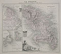
| ընթացիկ | 04:07, 10 Հուլիսի 2008 |  | 737 × 656 (135 ԿԲ) | Cartol | {{Information |Description=Hand-coloured map of Martinique (right), French Guiana (top left) and Saint Pierre and Miquelon (bottom left). An illustration of Fort-de-France is shown at the lower centre of the map. |Source=[http://www.bergbook.com/htdocs/Ca |
Նիշքի օգտագործում
Հետևյալ 2 էջերը հղվում են այս նիշքին՝
Նիշքի համընդհանուր օգտագործում
Հետևյալ այլ վիքիները օգտագործում են այս նիշքը՝
- Օգտագործումը en.wikipedia.org կայքում