Պատկեր:Comoros location map Topographic.png

Նախադիտման չափ՝ 745 × 600 պիքսել։ Այլ թույլտվությաններ: 298 × 240 պիքսել | 596 × 480 պիքսել | 954 × 768 պիքսել | 1272 × 1024 պիքսել | 1835 × 1477 պիքսել.
Սկզբնական նիշք (1835 × 1477 փիքսել, նիշքի չափը՝ 684 ԿԲ, MIME-տեսակը՝ image/png)
Ամփոփում
| Նկարագրում |
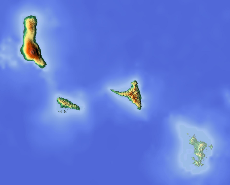
Deutsch: Positionskarte der Komoren
Quadratische Plattkarte. Geographische Begrenzung der Karte:
English: Location map of the Comoros
Equirectangular projection. Geographic limits of the map:
|
| Թվական | |
| Աղբյուր | Բեռնողի սեփական աշխատանք (backgroung : http://www.maps-for-free.com) |
| Հեղինակ | Dr Brains |
Արտոնագրում
Ես, այս աշխատանքի հեղինակային իրավունքների տերը, ներկա հրատարակում եմ սրա հետևյալ լիցենզիաների պայմաններով

|
Permission is granted to copy, distribute and/or modify this document under the terms of the GNU Free Documentation License, Version 1.2 only as published by the Free Software Foundation; with no Invariant Sections, no Front-Cover Texts, and no Back-Cover Texts. A copy of the license is included in the section entitled GNU Free Documentation License. | 1.2 only |
|
|
Permission is granted to copy, distribute and/or modify this document under the terms of the GNU Free Documentation License, Version 1.3 or any later version published by the Free Software Foundation; with no Invariant Sections, no Front-Cover Texts, and no Back-Cover Texts. A copy of the license is included in the section entitled GNU Free Documentation License.
|
Կարող եք ընտրել այս թույլատրագրերից ցանկացածը։
Նիշքի պատմություն
Մատնահարեք օրվան/ժամին՝ նիշքի այդ պահին տեսքը դիտելու համար։
| Օր/Ժամ | Մանրապատկեր | Օբյեկտի չափը | Մասնակից | Մեկնաբանություն | |
|---|---|---|---|---|---|
| ընթացիկ | 11:14, 12 Հունիսի 2018 | | 1835 × 1477 (684 ԿԲ) | Larske | Cropped to have the same longitude and latitude limits as the file Comoros location map.svg |
| 18:50, 15 Հունիսի 2012 |  | 2000 × 1589 (705 ԿԲ) | Dr Brains |
Նիշքի օգտագործում
Հետևյալ 2 էջերը հղվում են այս նիշքին՝
Նիշքի համընդհանուր օգտագործում
Հետևյալ այլ վիքիները օգտագործում են այս նիշքը՝
- Օգտագործումը ar.wikipedia.org կայքում
- Օգտագործումը ast.wikipedia.org կայքում
- Օգտագործումը bg.wikipedia.org կայքում
- Օգտագործումը bn.wikipedia.org կայքում
- Օգտագործումը bs.wikipedia.org կայքում
- Օգտագործումը ca.wikipedia.org կայքում
- Օգտագործումը ceb.wikipedia.org կայքում
- Օգտագործումը el.wikipedia.org կայքում
- Օգտագործումը en.wikipedia.org կայքում
- Օգտագործումը fa.wikipedia.org կայքում
- Օգտագործումը fr.wikipedia.org կայքում
- Anjouan
- Mohéli
- Karthala
- Grande Comore
- Combat d'Anjouan
- Parc marin de Mohéli
- Modèle:Géolocalisation/Comores
- La Grille
- Projet:Cartographie/Géolocalisation/Maintenance/Images des pays
- Lac Dzialandzé
- Modèle:Géolocalisation/Comores/Documentation
- Lac Niamawi
- Mont Ntringui
- Dar-Salama Mbadjini
- Fani Maoré
- Moindzaza Mboini
- Օգտագործումը he.wikipedia.org կայքում
- Օգտագործումը hr.wikipedia.org կայքում
- Օգտագործումը hsb.wikipedia.org կայքում
- Օգտագործումը ja.wikipedia.org կայքում
- Օգտագործումը kn.wikipedia.org կայքում
- Օգտագործումը ko.wikipedia.org կայքում
- Օգտագործումը lld.wikipedia.org կայքում
Տեսնել այս նիշքի ավելի համընդհանուր օգտագործումը: