Պատկեր:Caucasus central asia political map 2000.jpg

Նախադիտման չափ՝ 800 × 596 պիքսել։ Այլ թույլտվությաններ: 320 × 239 պիքսել | 640 × 477 պիքսել | 1024 × 763 պիքսել | 1280 × 954 պիքսել | 1390 × 1036 պիքսել.
Սկզբնական նիշք (1390 × 1036 փիքսել, նիշքի չափը՝ 164 ԿԲ, MIME-տեսակը՝ image/jpeg)
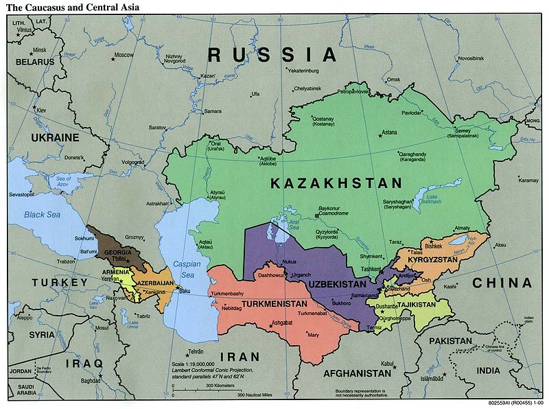
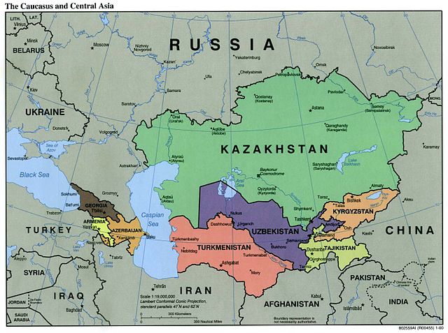
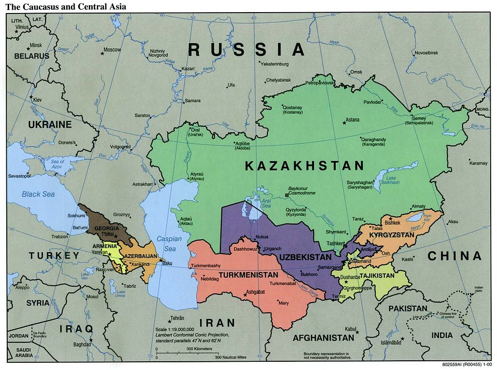
| Նկարագրում | Political Map of the Caucasus and Central Asia | ||||||
| Աղբյուր | http://ftp.lib.utexas.edu/maps/kazakhstan.html (CIA-Scans) | ||||||
| Հեղինակ | CIA | ||||||
| Իրավունքներ (Նիշքի վերաօգտագործումը) |
|
||||||
| Այլ մեկնակերպներ | Derivative works of this file: Central Asia - political map.svg | ||||||

Նիշքի պատմություն
Մատնահարեք օրվան/ժամին՝ նիշքի այդ պահին տեսքը դիտելու համար։
| Օր/Ժամ | Մանրապատկեր | Օբյեկտի չափը | Մասնակից | Մեկնաբանություն | |
|---|---|---|---|---|---|
| ընթացիկ | 01:20, 9 Նոյեմբերի 2004 | | 1390 × 1036 (164 ԿԲ) | Annalog~commonswiki | The Caucasus and Central Asia Political Map 2000 |
Նիշքի օգտագործում
Այս նիշքին օգտագործող էջեր չկան։
Նիշքի համընդհանուր օգտագործում
Հետևյալ այլ վիքիները օգտագործում են այս նիշքը՝
- Օգտագործումը en.wikipedia.org կայքում
- Օգտագործումը es.wikipedia.org կայքում
- Օգտագործումը id.wikipedia.org կայքում
- Օգտագործումը jv.wikipedia.org կայքում
- Օգտագործումը min.wikipedia.org կայքում
- Օգտագործումը ml.wikipedia.org կայքում
- Օգտագործումը ro.wikipedia.org կայքում
- Օգտագործումը te.wikipedia.org կայքում
- Օգտագործումը th.wikipedia.org կայքում
- Օգտագործումը tl.wikipedia.org կայքում
- Օգտագործումը zh-min-nan.wikipedia.org կայքում