Պատկեր:Canada Newfoundland and Labrador location map.svg

Size of this PNG preview of this SVG file: 419 × 599 պիքսել. Այլ թույլտվությաններ: 168 × 240 պիքսել | 336 × 480 պիքսել | 537 × 768 պիքսել | 716 × 1024 պիքսել | 1432 × 2048 պիքսել | 1512 × 2162 պիքսել.
Սկզբնական նիշք (SVG-նիշք, անվանապես 1512 × 2162 փիքսել, նիշքի չափը՝ 1,15 ՄԲ)
Ամփոփում
| Նկարագրում |
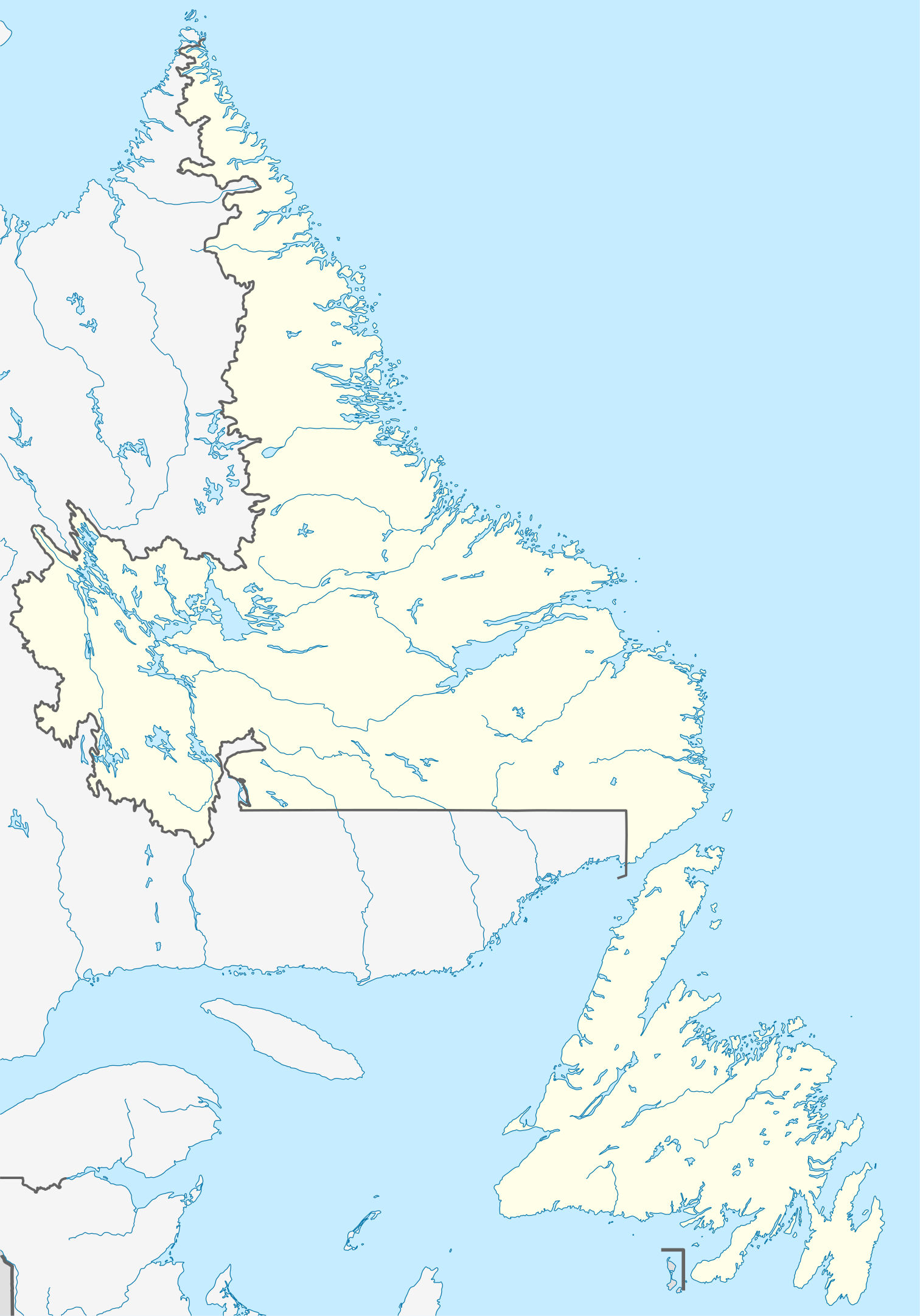
Quadratische Plattkarte, N-S-Streckung 160 %. Geographische Begrenzung der Karte:
Equirectangular projection, N/S stretching 160 %. Geographic limits of the map:
|
| Թվական | |
| Աղբյուր |
Բեռնողի սեփական աշխատանք, using
|
| Հեղինակ | NordNordWest |
| Իրավունքներ (Նիշքի վերաօգտագործումը) |
Ես, սույն աշխատանքի հեղինակային իրավունքների տերը, այսուհետ այն հրատարակում եմ հետևյալ արտոնագրի ներքո։ Այս նիշքը հասանելի է Creative Commons Attribution-Share Alike 3.0 Unported արտոնագրի ներքո:
|
| Այլ մեկնակերպներ |
Derivative works of this file: Labrador Region Map with Towns and Highway.svg
|


|
Այս քարտեզը բարելավված է եղել գերմանական Kartenwerkstatt-ում: Դուք կարող եք նաև առաջարկել այլ քարտեզներ դրանց բարելավման համար:
|
Նիշքի պատմություն
Մատնահարեք օրվան/ժամին՝ նիշքի այդ պահին տեսքը դիտելու համար։
| Օր/Ժամ | Մանրապատկեր | Օբյեկտի չափը | Մասնակից | Մեկնաբանություն | |
|---|---|---|---|---|---|
| ընթացիկ | 14:38, 28 Օգոստոսի 2009 | | 1512 × 2162 (1,15 ՄԲ) | NordNordWest | {{int:filedesc}} {{Information |Description= {{de|Positionskarte von Neufundland und Labrador, Kanada}} Quadratische Plattkarte, N-S-Streckung 160 %. Geographische Begrenzung der Karte: * N: 60.8° N * S: 46 |
Նիշքի օգտագործում
Հետևյալ էջը հղվում է այս նիշքին՝
Նիշքի համընդհանուր օգտագործում
Հետևյալ այլ վիքիները օգտագործում են այս նիշքը՝
- Օգտագործումը af.wikipedia.org կայքում
- Օգտագործումը ar.wikipedia.org կայքում
- Օգտագործումը ba.wikipedia.org կայքում
- Օգտագործումը ce.wikipedia.org կայքում
- Օգտագործումը cs.wikipedia.org կայքում
- Օգտագործումը de.wikipedia.org կայքում
- St. John’s (Neufundland)
- Gros-Morne-Nationalpark
- Dildo (Neufundland)
- Gander
- Wasserkraftwerk Churchill Falls
- Channel-Port aux Basques
- Peterview
- Grand Falls-Windsor
- Badger (Neufundland und Labrador)
- Labrador City
- Happy Valley-Goose Bay
- L’Anse-au-Clair
- Red Bay (Neufundland und Labrador)
- Gander International Airport
- Mount Pearl
- Corner Brook
- Deer Lake (Neufundland)
- Stephenville (Neufundland)
- Twillingate
- Conception Bay South
- St. Anthony (Neufundland)
- L’Anse-Amour
- Arnold’s Cove
- North River (Town, Neufundland)
- Wikipedia:Kartenwerkstatt/Positionskarten/Nordamerika
- Ferryland
- Vorlage:Positionskarte Kanada Neufundland und Labrador
- Cape St. Mary’s
- Benutzer:Zuviele Interessen/Hvítramannaland
- Cape Race Lighthouse
- Come By Chance (Neufundland und Labrador)
- Point of Bay
- Mary Brown’s Centre
- Wabush
- Stephenville International Airport
- Admirals Beach
- Harbour Grace
- Point Rosee
- Sop’s Arm
- Vorlage:Positionskarte Kanada Neufundland
- Point Amour Lighthouse
- World U-17 Hockey Challenge 2004
- Placentia (Neufundland und Labrador)
Տեսնել այս նիշքի ավելի համընդհանուր օգտագործումը: