Պատկեր:Butterfield-Overland.gif
Սկզբնական նիշք (2509 × 1021 փիքսել, նիշքի չափը՝ 1,04 ՄԲ, MIME-տեսակը՝ image/gif)
Ամփոփում
| Նկարագրում |
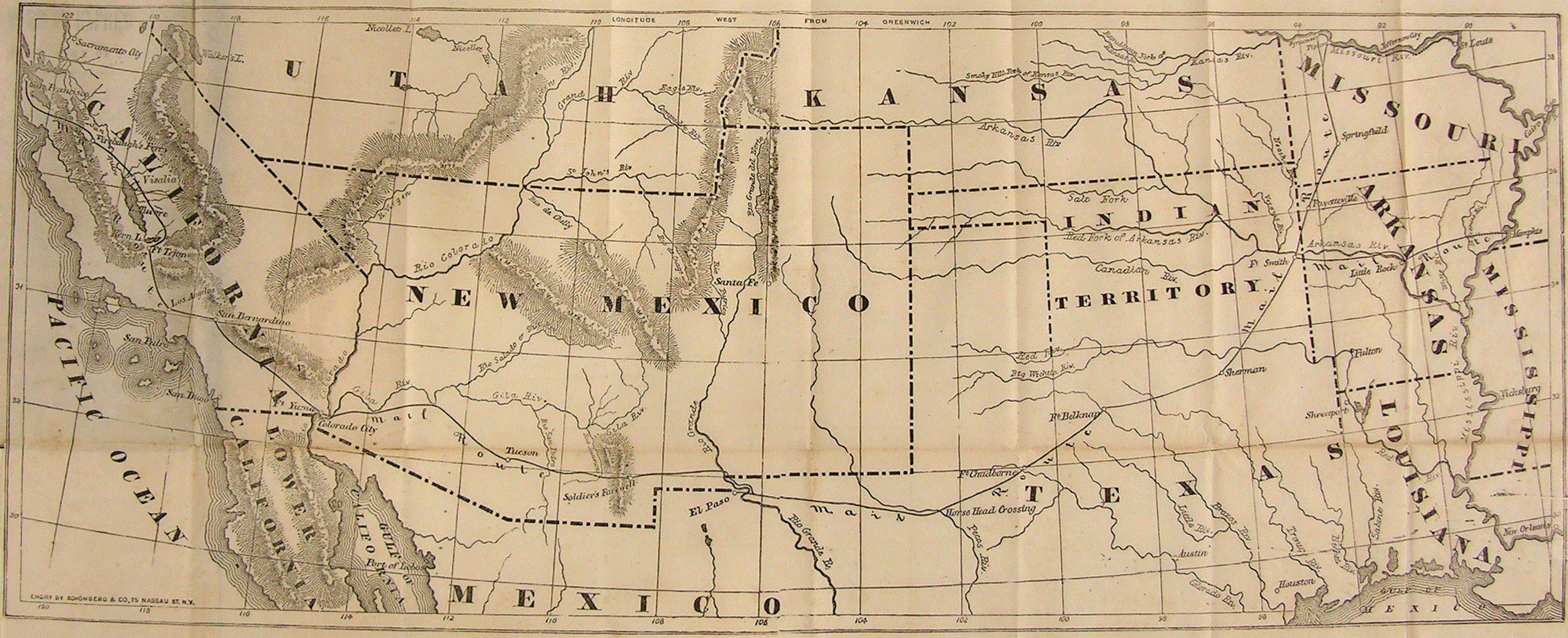
English: Foldout map of the Southwestern United States with territories and "Mail Route" of the Overland Mail Company contracted for $600,000 per year in 1857. Service began when the "first eastbound stagecoach departed San Francisco on September 15, 1858, and the westbound stagecoach left St. Louis a day later." The "DAILY LINE, from St.Louis to Springfield, Mo." was through en:Tipton, Missouri until the tbd railway was extended in 1859 along the preceding stage route to "The George Shackelford Relay and Meal Station" in en:Syracuse, Missouri. The "southern route" through the 1854 Gadsden Purchase region was abandoned in 1861 for the central route through the Kansas and Utah Territories (former Pony Express Route, not shown).
ERRATA
NAMES
|
||||
| Թվական | circa 1858(cartography) | ||||
| Աղբյուր |
|
||||
| Հեղինակ | author produced map prior to 1923 | ||||
| Իրավունքներ (Նիշքի վերաօգտագործումը) |
|
||||
| Այլ մեկնակերպներ | |||||
.gif)
Նիշքի պատմություն
Մատնահարեք օրվան/ժամին՝ նիշքի այդ պահին տեսքը դիտելու համար։
| Օր/Ժամ | Մանրապատկեր | Օբյեկտի չափը | Մասնակից | Մեկնաբանություն | |
|---|---|---|---|---|---|
| ընթացիկ | 17:55, 12 Օգոստոսի 2013 | 2509 × 1021 (1,04 ՄԲ) | 30 SW | Foldout map of the Southwestern United States with "Mail Route" of the Overland Mail Company contracted for $600,000 per year in 1857. Service began when the "first eastbound stagec... | |
| 17:55, 12 Օգոստոսի 2013 | 2509 × 1021 (1,04 ՄԲ) | 30 SW | Foldout map of the Southwestern United States with "Mail Route" of the Overland Mail Company contracted for $600,000 per year in 1857. Service began when the "first eastbound stagec... | ||
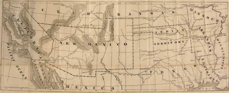
| 09:52, 13 Հոկտեմբերի 2011 |  | 850 × 367 (232 ԿԲ) | SreeBot | (Original text) : Overlay with the route marked in red, by John Cross | |
| 09:51, 13 Հոկտեմբերի 2011 |  | 850 × 367 (253 ԿԲ) | SreeBot | (Original text) : {{Information |Description = Historic 19th Century Map with Highlighted overlay of the route |Source = http://www.postalmuseum.si.edu/museum/1d_Butterfield.html |Date = Mid-19th Century |Author = Butterfi |
Նիշքի օգտագործում
Այս նիշքին օգտագործող էջեր չկան։
Նիշքի համընդհանուր օգտագործում
Հետևյալ այլ վիքիները օգտագործում են այս նիշքը՝
- Օգտագործումը de.wikipedia.org կայքում
- Օգտագործումը en.wikipedia.org կայքում