Պատկեր:Гербер Каспий 1728.jpg

Նախադիտման չափ՝ 428 × 599 պիքսել։ Այլ թույլտվությաններ: 171 × 240 պիքսել | 343 × 480 պիքսել | 548 × 768 պիքսել | 731 × 1024 պիքսել | 1463 × 2048 պիքսել | 4318 × 6045 պիքսել.
Սկզբնական նիշք (4318 × 6045 փիքսել, նիշքի չափը՝ 3,59 ՄԲ, MIME-տեսակը՝ image/jpeg)
Ամփոփում
| Նկարագրում |
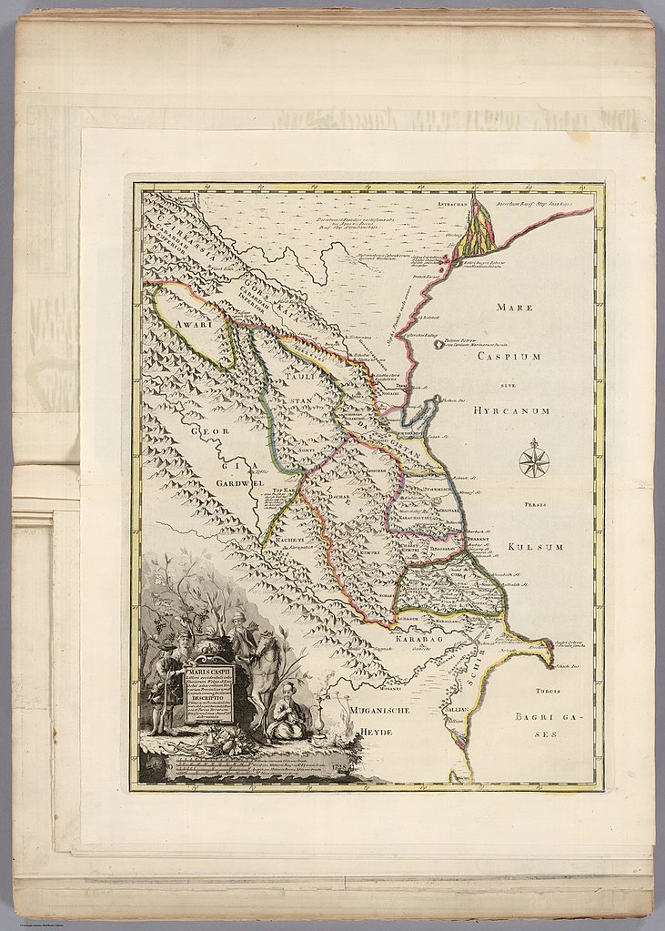
Русский: Карта Кавказа, составленная И. Г. Гербером в 1728 году |
| Թվական | |
| Աղբյուր | Издание: СПб., 1736. |
| Հեղինակ | Гербер, Иоанн Густав (ок. 1690—1734) — российский полковник артиллерии. |
| Այլ մեկնակերպներ |
.jpg)
Արտոնագրում
|
This is a faithful photographic reproduction of a two-dimensional, public domain work of art. The work of art itself is in the public domain in its source country for the following reason:
It is also in the public domain in the United States for the following reason:
The official position taken by the Wikimedia Foundation is that "faithful reproductions of two-dimensional public domain works of art are public domain".
This photographic reproduction is therefore also considered to be in the public domain in the United States. In other jurisdictions, re-use of this content may be restricted; see Reuse of PD-Art photographs for details.
| ||||||
Նիշքի պատմություն
Մատնահարեք օրվան/ժամին՝ նիշքի այդ պահին տեսքը դիտելու համար։
| Օր/Ժամ | Մանրապատկեր | Օբյեկտի չափը | Մասնակից | Մեկնաբանություն | |
|---|---|---|---|---|---|
| ընթացիկ | 19:43, 8 Ապրիլի 2021 | | 4318 × 6045 (3,59 ՄԲ) | Yousiphh | Reverted to version as of 01:11, 12 October 2014 (UTC) |
| 20:24, 27 Հունիսի 2015 |  | 748 × 974 (680 ԿԲ) | Maqivi | обрезано | |
| 01:11, 12 Հոկտեմբերի 2014 |  | 4318 × 6045 (3,59 ՄԲ) | 91i79 | == {{int:filedesc}} == {{Information |Description={{ru|1=Карта Кавказа, составленная И. Г. Гербером в 1728 году}} |Source= Издание: СПб., 1736. |Author=Гербер, Иоанн Густав (ок. 1690�... |
Նիշքի օգտագործում
Հետևյալ էջը հղվում է այս նիշքին՝
Նիշքի համընդհանուր օգտագործում
Հետևյալ այլ վիքիները օգտագործում են այս նիշքը՝
- Օգտագործումը az.wikipedia.org կայքում
- Օգտագործումը ce.wikipedia.org կայքում
- Օգտագործումը el.wikipedia.org կայքում
- Օգտագործումը et.wikipedia.org կայքում
- Օգտագործումը fr.wikipedia.org կայքում
- Օգտագործումը it.wikipedia.org կայքում
- Օգտագործումը ja.wikipedia.org կայքում
- Օգտագործումը ku.wikipedia.org կայքում
- Օգտագործումը lez.wikipedia.org կայքում
- Օգտագործումը ru.wikipedia.org կայքում
- Օգտագործումը ru.wikiquote.org կայքում
- Օգտագործումը tr.wikipedia.org կայքում
- Օգտագործումը uk.wikipedia.org կայքում
- Օգտագործումը zh.wikipedia.org կայքում