Պատկեր:Wisconsin in 1718.jpg
Ավելի բարձր կետաչափով տարբերակ չկա։
Wisconsin_in_1718.jpg (640 × 480 փիքսել, նիշքի չափը՝ 184 ԿԲ, MIME-տեսակը՝ image/jpeg)
Ամփոփում
| Նկարագրում |
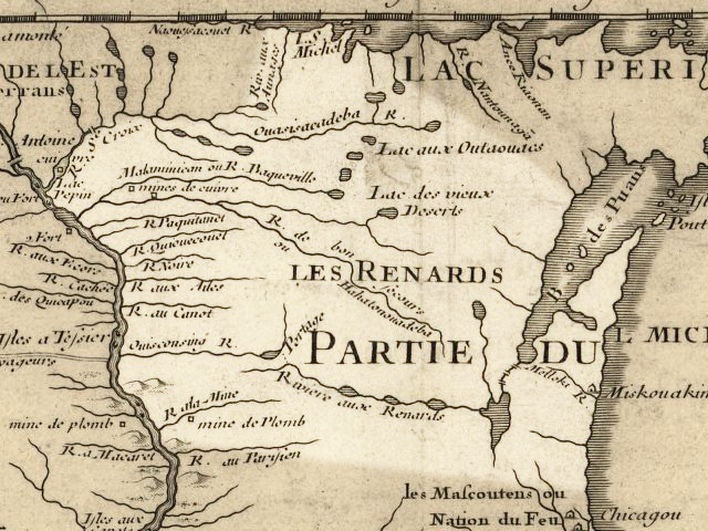
English: Wisconsin 1718, approximate modern state area highlighted, from Carte de la Louisiane et du cours du Mississipi by Guillaume de L'Isle. |
|||||||||||||||||||||||
| Թվական | (mod. 2009) | |||||||||||||||||||||||
| Աղբյուր | Library of Congress Public Domain Site: http://hdl.loc.gov/loc.gmd/g3700.ct000666 | |||||||||||||||||||||||
| Հեղինակ |
|
|||||||||||||||||||||||
| Իրավունքներ (Նիշքի վերաօգտագործումը) |
US Govt Public Domain, also author +100 years | |||||||||||||||||||||||

Արտոնագրում
|
This work is in the public domain in its country of origin and other countries and areas where the copyright term is the author's life plus 100 years or fewer. | |
| This file has been identified as being free of known restrictions under copyright law, including all related and neighboring rights. | |
Original upload log
The original description page was here. All following user names refer to en.wikipedia.
- 2009-07-24 20:14 Billwhittaker 640×480× (188239 bytes) {{Information |Description = Wisconsin 1718, approximate modern state area highlighted, from Carte de la Louisiane et du cours du Mississipi by Guillaume de L'Isle. |Source = Library of Congress Public Domain Site: http://hdl.loc.gov/loc.gmd
Նիշքի պատմություն
Մատնահարեք օրվան/ժամին՝ նիշքի այդ պահին տեսքը դիտելու համար։
| Օր/Ժամ | Մանրապատկեր | Օբյեկտի չափը | Մասնակից | Մեկնաբանություն | |
|---|---|---|---|---|---|
| ընթացիկ | 19:37, 21 Սեպտեմբերի 2009 | | 640 × 480 (184 ԿԲ) | Jeangagnon | {{Information |Description={{en|Wisconsin 1718, approximate modern state area highlighted, from ''Carte de la Louisiane et du cours du Mississipi'' by en:Guillaume de L'Isle.}} |Source=Transferred from [http://en.wikipedia.org en.wikipedia]<br/> (Or |
Նիշքի օգտագործում
Հետևյալ էջը հղվում է այս նիշքին՝
Նիշքի համընդհանուր օգտագործում
Հետևյալ այլ վիքիները օգտագործում են այս նիշքը՝
- Օգտագործումը arz.wikipedia.org կայքում
- Օգտագործումը azb.wikipedia.org կայքում
- Օգտագործումը bo.wikipedia.org կայքում
- Օգտագործումը ceb.wikipedia.org կայքում
- Օգտագործումը cs.wikipedia.org կայքում
- Օգտագործումը de.wikipedia.org կայքում
- Օգտագործումը en.wikipedia.org կայքում
- Օգտագործումը es.wikipedia.org կայքում
- Օգտագործումը et.wikipedia.org կայքում
- Օգտագործումը fr.wikipedia.org կայքում
- Օգտագործումը hr.wiktionary.org կայքում
- Օգտագործումը hsb.wikipedia.org կայքում
- Օգտագործումը it.wikipedia.org կայքում
- Օգտագործումը ja.wikipedia.org կայքում
- Օգտագործումը kn.wikipedia.org կայքում
- Օգտագործումը ko.wikipedia.org կայքում
- Օգտագործումը ml.wikipedia.org կայքում
- Օգտագործումը pt.wikipedia.org կայքում
- Օգտագործումը simple.wikipedia.org կայքում
- Օգտագործումը te.wikipedia.org կայքում