Պատկեր:Turkey Istanbul location map.svg

Սկզբնական նիշք (SVG-նիշք, անվանապես 1568 × 845 փիքսել, նիշքի չափը՝ 424 ԿԲ)
Ամփոփում
| Նկարագրում |
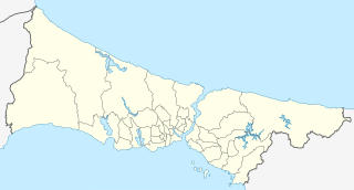
Geographische Begrenzung der Karte:
Geographic limits of the map:
|
| Թվական | |
| Աղբյուր |
Own work using: File:Istanbul location districts.svg by |
| Հեղինակ | NordNordWest |

|
Այս քարտեզը բարելավված է եղել գերմանական Kartenwerkstatt-ում: Դուք կարող եք նաև առաջարկել այլ քարտեզներ դրանց բարելավման համար:
|
Արտոնագրում
Usage of this file with:

explanatory notes: Legally binding is only the full legalcode. For a free usage I recommend to respect the following licence conditions:
1. Provide my name as given above: NordNordWest,
2. a copy of, or the URI for, the applicable license: https://creativecommons.org/licenses/by-sa/3.0/de/legalcode,
3. the title of the work,
4. in the case of an adaptation, a credit identifying the use of the work in the adaptation.
This license and the rights granted hereunder will terminate automatically upon any breach by you of the terms of this license. Any of the above conditions can be waived if you get permission from the copyright holder. If you have questions or wish differing conditions, please contact me through nnwest or my discussion page ![]() t-online.de
t-online.de
- Դուք ազատ եք՝
- կիսվել ստեղծագործությամբ – պատճենել, տարածել և փոխանցել այս աշխատանքը։
- վերափոխել – ադապտացնել աշխատանքը
- Պահպանելով հետևյալ պայմանները'
- հղում – Դուք պետք է նշեք հեղինակի (իրավատիրոջ) հղումը:
- համանման տարածում – Եթե դուք ձևափոխում եք, փոխակերպում, կամ այս աշխատանքի հիման վրա ստեղծում եք նոր աշխատանք, ապա ձեր ստեղծածը կարող է տարածվել միայն նույն կամ համարժեք թույլատրագրով։

Նիշքի պատմություն
Մատնահարեք օրվան/ժամին՝ նիշքի այդ պահին տեսքը դիտելու համար։
| Օր/Ժամ | Մանրապատկեր | Օբյեկտի չափը | Մասնակից | Մեկնաբանություն | |
|---|---|---|---|---|---|
| ընթացիկ | 17:26, 6 Ապրիլի 2018 | | 1568 × 845 (424 ԿԲ) | NordNordWest | upd |
| 11:37, 16 Օգոստոսի 2014 |  | 1568 × 845 (465 ԿԲ) | NordNordWest | == {{int:filedesc}} == {{Information |Description= {{de|Positionskarte der Provinz Istanbul, Türkei}} Geographische Begrenzung der Karte: * N: 41.619888° N * S: 40.796666° N * W: 27.941666° O * O: 29.97388... |
Նիշքի օգտագործում
Հետևյալ 5 էջերը հղվում են այս նիշքին՝
Նիշքի համընդհանուր օգտագործում
Հետևյալ այլ վիքիները օգտագործում են այս նիշքը՝
- Օգտագործումը ar.wikipedia.org կայքում
- Օգտագործումը azb.wikipedia.org կայքում
- Օգտագործումը az.wikipedia.org կայքում
- Ayasofiya
- Topqapı sarayı
- Əyyub Sultan məscidi
- Sultan Əhməd məscidi
- Zal Mahmud paşa məscidi
- Ulduz sarayı
- Laləli məscidi
- Yavuz Sultan Səlim külliyəsi
- Bəyazid məscidi
- İbrahim Paşa Sarayı
- Ulduz Saat Qülləsi
- Abdi İpəkçi sui-qəsdi
- Rumeli Hasarı
- Yeni məscid (İstanbul)
- Mehrimah Sultan məscidi (Üsküdar)
- Haseki hamamı
- Ağa hamamı
- Dolmabağça saat qülləsi
- Topxana saat qülləsi
- Nuruosmaniyə məscidi
- Atatürk körpüsü
- Yeddiqüllə zindanları
- İstanbul Əşkinazi sinaqoqu
- Küçüksu sarayı
- Hidiv qəsri
- Səbətçilər sarayı
- İhlamur sarayı
- Florya Atatürk Dəniz Köşkü
- Çırağan sarayı
- Şablon:Yer xəritəsi Türkiyə İstanbul
- Fateh məscidi (İstanbul)
- Kiçik Vlaxerna sarayı
- İstanbul Hava Limanı
- Lütfü Kırdar Konqres və Sərgi Sarayı (İstanbul)
- Ulduz Həmidiyyə məscidi
- Böyük İstanbul avtovağzalı
- Türkiyə Super Liqası 2021/2022
- Türkiyə Super Liqası 2020/2021
- Türkiyə Super Liqası 2019/2020
- Türkiyə Super Liqası 2018/2019
- Օգտագործումը bn.wikipedia.org կայքում
Տեսնել այս նիշքի ավելի համընդհանուր օգտագործումը: