Պատկեր:Queen-Pyramid-G-III-b.jpg
Ավելի բարձր կետաչափով տարբերակ չկա։
Queen-Pyramid-G-III-b.jpg (411 × 242 փիքսել, նիշքի չափը՝ 27 ԿԲ, MIME-տեսակը՝ image/jpeg)
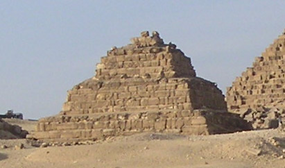
Queen Pyramid GIIIb of the Menkaure complex
Excerpt from Image:Gizeh Mykerinos 02.JPG
Ամփոփում
Vue de la face sud de la pyramide de Mykérinos à Gizeh avec ses trois pyramides de reines - IVe dynastie égyptienne
| Տեսախցիկի տեղագրություն | | Այս և ուրիշ պատկերներ իրենց տեղագրությամբ OpenStreetMap |
|---|
Արտոնագրում
| I, the copyright holder of this work, release this work into the public domain. This applies worldwide. In some countries this may not be legally possible; if so: I grant anyone the right to use this work for any purpose, without any conditions, unless such conditions are required by law. |
Source
Français : Auteur : Sebi.
Français : Appareil : Minolta DiMAGE Xt
Français : Date : Novembre 2004
Նիշքի պատմություն
Մատնահարեք օրվան/ժամին՝ նիշքի այդ պահին տեսքը դիտելու համար։
| Օր/Ժամ | Մանրապատկեր | Օբյեկտի չափը | Մասնակից | Մեկնաբանություն | |
|---|---|---|---|---|---|
| ընթացիկ | 12:53, 5 Մարտի 2008 | | 411 × 242 (27 ԿԲ) | GDK | Queen Pyramid GIIIb of the Menkaure complex Excerpt from Image:Gizeh Mykerinos 02.JPG == Description == Vue de la face sud de la pyramide de Mykérinos à Gizeh avec ses trois pyramides de reines - IVe dynastie égyptienne {{Location|29|58|13.0|N|3 |
Նիշքի օգտագործում
Հետևյալ էջը հղվում է այս նիշքին՝
Նիշքի համընդհանուր օգտագործում
Հետևյալ այլ վիքիները օգտագործում են այս նիշքը՝
- Օգտագործումը ar.wikipedia.org կայքում
- Օգտագործումը ba.wikipedia.org կայքում
- Օգտագործումը ca.wikipedia.org կայքում
- Օգտագործումը de.wikipedia.org կայքում
- Օգտագործումը el.wikipedia.org կայքում
- Օգտագործումը en.wikipedia.org կայքում
- Օգտագործումը fa.wikipedia.org կայքում
- Օգտագործումը fr.wikipedia.org կայքում
- Օգտագործումը hu.wikipedia.org կայքում
- Օգտագործումը it.wikipedia.org կայքում
- Օգտագործումը ru.wikipedia.org կայքում
- Օգտագործումը uk.wikipedia.org կայքում