Պատկեր:Persia 1814.jpg
Նախադիտման չափ՝ 718 × 600 պիքսել։ Այլ թույլտվությաններ: 287 × 240 պիքսել | 575 × 480 պիքսել | 920 × 768 պիքսել | 1226 × 1024 պիքսել | 2452 × 2048 պիքսել | 2931 × 2448 պիքսել.
Սկզբնական նիշք (2931 × 2448 փիքսել, նիշքի չափը՝ 1,6 ՄԲ, MIME-տեսակը՝ image/jpeg)
Ամփոփում
| Description |
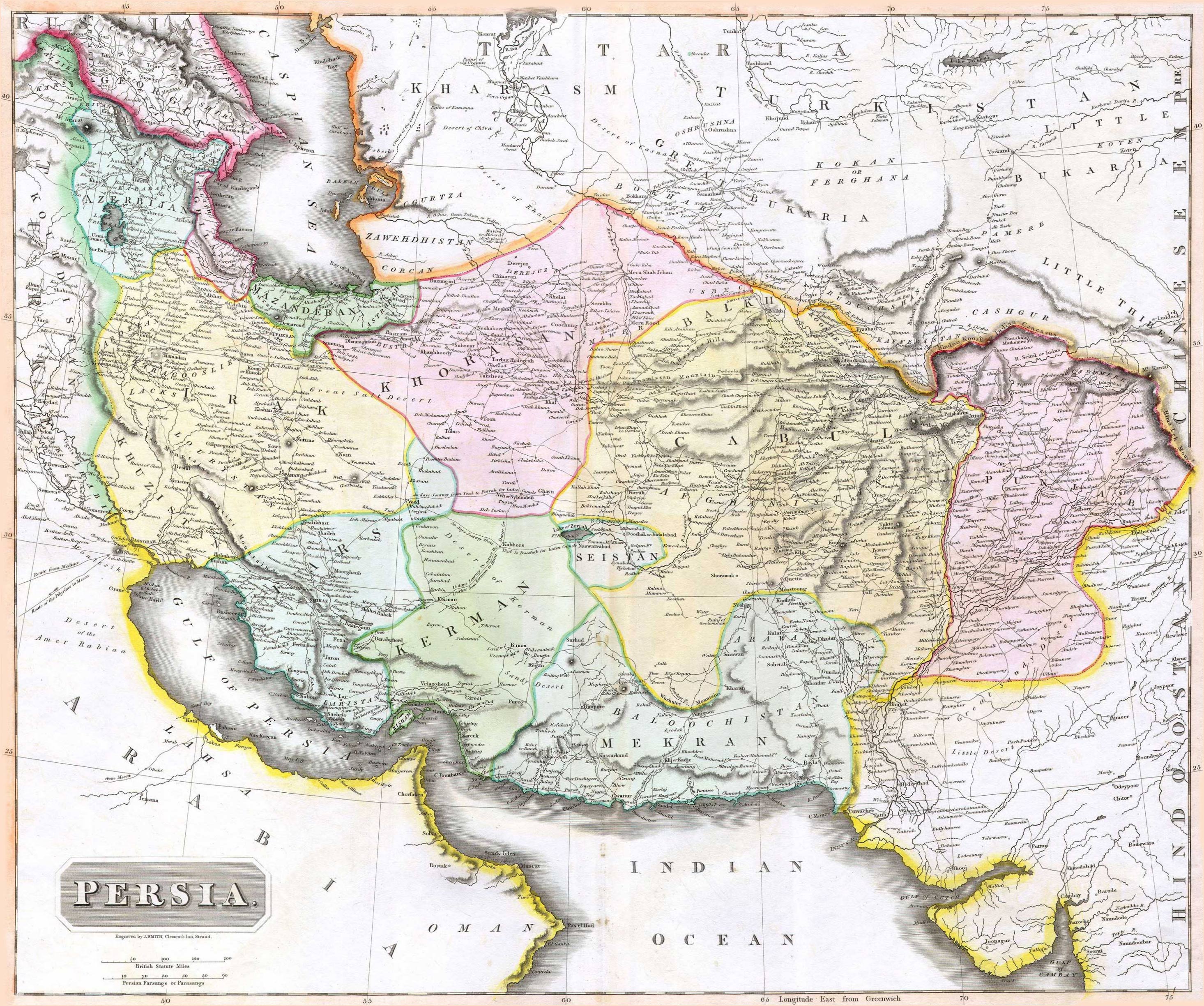
English: 1814 Thomson Map of Persia (Iran), engraved by J. Smith, Clement's Inn, Strand. |
| Թվական | |
| Ստեղծել է |
J. Smith, Clement's Inn, Strand. |
| Geotemporal data | |
| Map location | Iran |
| Georeferencing | If inappropriate please set warp_status = skip to hide. |
| Bibliographic data | |
| Հրատարակություն |
New General Atlas (1821) |
| Հեղինակ |
John Thomson |
| Այլ մեկնակերպներ | |

Արտոնագրում
The copyright situation of this work is theoretically uncertain, because in the country of origin copyright lasts 70 years after the death of the author, and the date of the author's death is unknown. However, the date of creation of the work was over 120 years ago, and it is thus a reasonable assumption that the copyright has expired (see here for the community discussion). Do not use this template if the date of death of the author is known.
This work is in the public domain in the United States because it was published (or registered with the U.S. Copyright Office) before January 1, 1929. | |
| This file has been identified as being free of known restrictions under copyright law, including all related and neighboring rights. | |
Նիշքի պատմություն
Մատնահարեք օրվան/ժամին՝ նիշքի այդ պահին տեսքը դիտելու համար։
| Օր/Ժամ | Մանրապատկեր | Օբյեկտի չափը | Մասնակից | Մեկնաբանություն | |
|---|---|---|---|---|---|
| ընթացիկ | 07:27, 18 Օգոստոսի 2010 | | 2931 × 2448 (1,6 ՄԲ) | Begoon | edge perspective and crop |
| 02:35, 19 Նոյեմբերի 2006 |  | 2979 × 2520 (1,45 ՄԲ) | Kaveh | == Summary == 1814 Thomson Map of Persia (Iran) Category:Maps of Iran == Licensing == {{PD-old}} |
Նիշքի օգտագործում
Հետևյալ էջը հղվում է այս նիշքին՝
Նիշքի համընդհանուր օգտագործում
Հետևյալ այլ վիքիները օգտագործում են այս նիշքը՝
- Օգտագործումը ar.wikipedia.org կայքում
- Օգտագործումը az.wikipedia.org կայքում
- Օգտագործումը be.wikipedia.org կայքում
- Օգտագործումը bn.wikipedia.org կայքում
- Օգտագործումը bs.wikipedia.org կայքում
- Օգտագործումը ca.wikipedia.org կայքում
- Օգտագործումը da.wikipedia.org կայքում
- Օգտագործումը de.wikipedia.org կայքում
- Օգտագործումը en.wikipedia.org կայքում
- Օգտագործումը es.wikipedia.org կայքում
- Օգտագործումը eu.wikipedia.org կայքում
- Օգտագործումը fa.wikipedia.org կայքում
- Օգտագործումը fr.wikipedia.org կայքում
- Օգտագործումը hi.wikipedia.org կայքում
- Օգտագործումը hr.wikipedia.org կայքում
Տեսնել այս նիշքի ավելի համընդհանուր օգտագործումը: