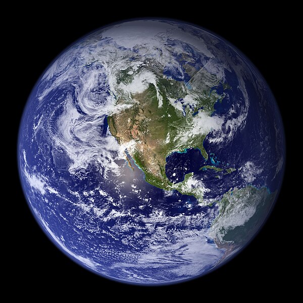
Պատկեր:NASA Earth America 2002.jpg

Նախադիտման չափ՝ 600 × 600 պիքսել։ Այլ թույլտվությաններ: 240 × 240 պիքսել | 480 × 480 պիքսել | 768 × 768 պիքսել | 1024 × 1024 պիքսել | 2048 × 2048 պիքսել.
Սկզբնական նիշք (2048 × 2048 փիքսել, նիշքի չափը՝ 588 ԿԲ, MIME-տեսակը՝ image/jpeg)
Նիշքի պատմություն
Մատնահարեք օրվան/ժամին՝ նիշքի այդ պահին տեսքը դիտելու համար։
| Օր/Ժամ | Մանրապատկեր | Օբյեկտի չափը | Մասնակից | Մեկնաբանություն | |
|---|---|---|---|---|---|
| ընթացիկ | 14:46, 26 Սեպտեմբերի 2014 |  | 2048 × 2048 (588 ԿԲ) | Orange-kun | Larger file from the same source |
| 07:55, 6 Մարտի 2010 |  | 1024 × 1024 (497 ԿԲ) | CrazyInSane | {{Information |Description={{en|1=A depiction of Earth from February 2002, view of America. Released in 2010 by NASA.}} |Source=http://www.flickr.com/photos/gsfc/4386822005/in/photostream/ |Author=NASA Goddard Space Flight Center Image by Reto Stöckl |Da |
Նիշքի օգտագործում
Հետևյալ էջը հղվում է այս նիշքին՝
Նիշքի համընդհանուր օգտագործում
Հետևյալ այլ վիքիները օգտագործում են այս նիշքը՝
- Օգտագործումը be.wikipedia.org կայքում
- Օգտագործումը bn.wikipedia.org կայքում
- Օգտագործումը bs.wikipedia.org կայքում
- Օգտագործումը cs.wikipedia.org կայքում
- Օգտագործումը en.wikipedia.org կայքում
- Օգտագործումը en.wikisource.org կայքում
- Օգտագործումը fa.wikipedia.org կայքում
- Օգտագործումը fy.wikipedia.org կայքում
- Օգտագործումը ku.wikipedia.org կայքում
- Օգտագործումը my.wikipedia.org կայքում
- Օգտագործումը nah.wikipedia.org կայքում
- Օգտագործումը pcd.wikipedia.org կայքում
- Օգտագործումը ro.wikipedia.org կայքում
- Օգտագործումը ru.wikipedia.org կայքում
- Օգտագործումը sat.wikipedia.org կայքում
- Օգտագործումը sr.wiktionary.org կայքում
- Օգտագործումը sv.wikipedia.org կայքում
- Օգտագործումը th.wikipedia.org կայքում
- Օգտագործումը tly.wikipedia.org կայքում
- Օգտագործումը ts.wikipedia.org կայքում
- Օգտագործումը tt.wikipedia.org կայքում
- Օգտագործումը uk.wikipedia.org կայքում
- Օգտագործումը ur.wikipedia.org կայքում
- Օգտագործումը www.wikidata.org կայքում

