Պատկեր:Manhattan1781.jpg
Նախադիտման չափ՝ 308 × 599 պիքսել։ Այլ թույլտվությաններ: 123 × 240 պիքսել | 247 × 480 պիքսել | 864 × 1680 պիքսել.
Սկզբնական նիշք (864 × 1680 փիքսել, նիշքի չափը՝ 893 ԿԲ, MIME-տեսակը՝ image/jpeg)
| Նկարագրում |
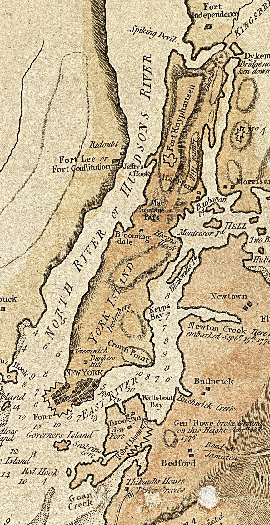
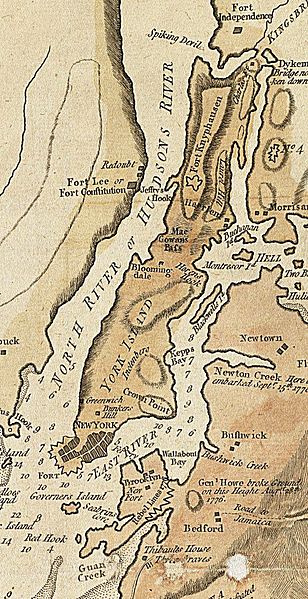
English: A section of a 1781 British map and nautical chart of New York and its harbor. Image has been cropped to show primarily Manhattan, color level adjusted, and sharpened from the original. |
||||
| Թվական | |||||
| Աղբյուր | Norman B. Levinson Map Center, Boston Public Library | ||||
| Հեղինակ | John Lodge, Publisher: Bew, John | ||||
| Իրավունքներ (Նիշքի վերաօգտագործումը) |
|
||||
Նիշքի պատմություն
Մատնահարեք օրվան/ժամին՝ նիշքի այդ պահին տեսքը դիտելու համար։
| Օր/Ժամ | Մանրապատկեր | Օբյեկտի չափը | Մասնակից | Մեկնաբանություն | |
|---|---|---|---|---|---|
| ընթացիկ | 02:16, 16 Մայիսի 2014 | | 864 × 1680 (893 ԿԲ) | Beyond My Ken | improve visibility |
| 19:26, 11 Դեկտեմբերի 2009 |  | 864 × 1680 (727 ԿԲ) | Magicpiano | {{Information |Description={{en|1=A section of a 1781 British map and nautical chart of New York and its harbor. Image has been cropped to show primarily Manhattan, color level adjusted, and sharpened from the original. }} |Source=http://maps.bpl.org/det |
Նիշքի օգտագործում
Հետևյալ էջը հղվում է այս նիշքին՝
Նիշքի համընդհանուր օգտագործում
Հետևյալ այլ վիքիները օգտագործում են այս նիշքը՝
- Օգտագործումը en.wikipedia.org կայքում
- Օգտագործումը es.wikipedia.org կայքում
- Օգտագործումը fr.wikipedia.org կայքում
- Օգտագործումը it.wikipedia.org կայքում
- Օգտագործումը ja.wikipedia.org կայքում
- Օգտագործումը sh.wikipedia.org կայքում
- Օգտագործումը vi.wikipedia.org կայքում