Պատկեր:LLNL Aerial View.jpg

Նախադիտման չափ՝ 800 × 554 պիքսել։ Այլ թույլտվությաններ: 320 × 222 պիքսել | 640 × 443 պիքսել | 975 × 675 պիքսել.
Սկզբնական նիշք (975 × 675 փիքսել, նիշքի չափը՝ 193 ԿԲ, MIME-տեսակը՝ image/jpeg)
Ամփոփում
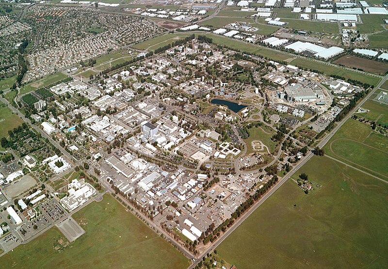
| Նկարագրում | Lawrence Livermore National Laboratory - aerial view. |
| Աղբյուր | llnl.gov |
| Հեղինակ |
| Տեսախցիկի տեղագրություն | | Այս և ուրիշ պատկերներ իրենց տեղագրությամբ OpenStreetMap |
|---|
Արտոնագրում
This work is in the public domain in the United States because it is a work prepared by an officer or employee of the United States Government as part of that person’s official duties under the terms of Title 17, Chapter 1, Section 105 of the US Code.
Note: This only applies to original works of the Federal Government and not to the work of any individual U.S. state, territory, commonwealth, county, municipality, or any other subdivision. This template also does not apply to postage stamp designs published by the United States Postal Service since 1978. (See § 313.6(C)(1) of Compendium of U.S. Copyright Office Practices). It also does not apply to certain US coins; see The US Mint Terms of Use.
|
 | |
| This file has been identified as being free of known restrictions under copyright law, including all related and neighboring rights. | ||
Նիշքի պատմություն
Մատնահարեք օրվան/ժամին՝ նիշքի այդ պահին տեսքը դիտելու համար։
| Օր/Ժամ | Մանրապատկեր | Օբյեկտի չափը | Մասնակից | Մեկնաբանություն | |
|---|---|---|---|---|---|
| ընթացիկ | 18:23, 11 Մայիսի 2005 | | 975 × 675 (193 ԿԲ) | Floriang | Lawrence Livermore National Laboratory - aerial view. Originally from [http://www.llnl.gov/llnl/06news/NewsMedia/photoarchive.html LLNL.gov]. Converted from LLNL_Aerial_View.png. ''Source'': en, uploaded by en:User:Bkell {{PD-USGov}} [[Category:B |
Նիշքի օգտագործում
Հետևյալ էջը հղվում է այս նիշքին՝
Նիշքի համընդհանուր օգտագործում
Հետևյալ այլ վիքիները օգտագործում են այս նիշքը՝
- Օգտագործումը ar.wikipedia.org կայքում
- Օգտագործումը bg.wikipedia.org կայքում
- Օգտագործումը ca.wikipedia.org կայքում
- Օգտագործումը ceb.wikipedia.org կայքում
- Օգտագործումը cs.wikipedia.org կայքում
- Օգտագործումը da.wikipedia.org կայքում
- Օգտագործումը de.wikipedia.org կայքում
- Օգտագործումը de.wikibooks.org կայքում
- Օգտագործումը de.wikinews.org կայքում
- Օգտագործումը el.wikipedia.org կայքում
- Օգտագործումը en.wikipedia.org կայքում
- University of California
- Lawrence Livermore National Laboratory
- Livermore, California
- Northern California
- User:Bkell/Images
- Portal:San Francisco Bay Area/Selected article/Archive
- History of the University of California, Berkeley
- Portal:San Francisco Bay Area/Selected article/39
- Portal:San Francisco Bay Area/Years/Archive
- Portal:San Francisco Bay Area/Years/63
- Timeline of the San Francisco Bay Area
- Օգտագործումը en.wikibooks.org կայքում
- Օգտագործումը en.wikinews.org կայքում
- Օգտագործումը en.wikivoyage.org կայքում
- Օգտագործումը eo.wikipedia.org կայքում
- Օգտագործումը es.wikipedia.org կայքում
- Օգտագործումը et.wikipedia.org կայքում
- Օգտագործումը fa.wikipedia.org կայքում
- Օգտագործումը fr.wikipedia.org կայքում
- Օգտագործումը gd.wikipedia.org կայքում
- Օգտագործումը he.wikipedia.org կայքում
- Օգտագործումը hi.wikipedia.org կայքում
- Օգտագործումը id.wikipedia.org կայքում
- Օգտագործումը it.wikipedia.org կայքում
- Օգտագործումը ja.wikipedia.org կայքում
- Օգտագործումը ko.wikipedia.org կայքում
- Օգտագործումը kw.wikipedia.org կայքում
- Օգտագործումը nn.wikipedia.org կայքում
- Օգտագործումը no.wikipedia.org կայքում
Տեսնել այս նիշքի ավելի համընդհանուր օգտագործումը: