Պատկեր:Europe 1360.jpg
Նախադիտման չափ՝ 800 × 493 պիքսել։ Այլ թույլտվությաններ: 320 × 197 պիքսել | 640 × 394 պիքսել | 1024 × 631 պիքսել | 1280 × 789 պիքսել | 1817 × 1120 պիքսել.
Սկզբնական նիշք (1817 × 1120 փիքսել, նիշքի չափը՝ 695 ԿԲ, MIME-տեսակը՝ image/jpeg)
Ամփոփում
| Նկարագրում |
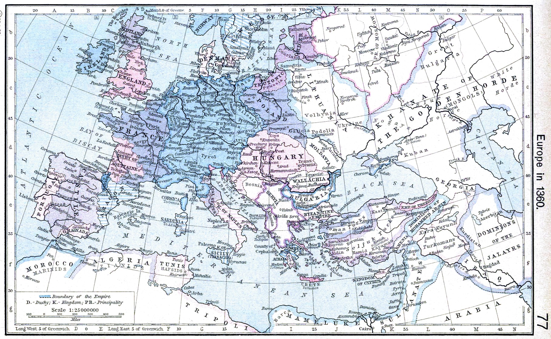
English: Europe in 1360. |
||||||||||||||||||||||
| Թվական | |||||||||||||||||||||||
| Աղբյուր | http://www.lib.utexas.edu/maps/historical/shepherd/europe_1360.jpg | ||||||||||||||||||||||
| Հեղինակ |
|
||||||||||||||||||||||
| Այլ մեկնակերպներ | Derivative works of this file: | ||||||||||||||||||||||
.jpg)
_en.png)
.png)
.jpg)
Արտոնագրում
|
The author died in 1934, so this work is in the public domain in its country of origin and other countries and areas where the copyright term is the author's life plus 80 years or fewer. This work is in the public domain in the United States because it was published (or registered with the U.S. Copyright Office) before January 1, 1929. | |
| This file has been identified as being free of known restrictions under copyright law, including all related and neighboring rights. | |
Նիշքի պատմություն
Մատնահարեք օրվան/ժամին՝ նիշքի այդ պահին տեսքը դիտելու համար։
| Օր/Ժամ | Մանրապատկեր | Օբյեկտի չափը | Մասնակից | Մեկնաբանություն | |
|---|---|---|---|---|---|
| ընթացիկ | 20:51, 24 Ապրիլի 2009 | | 1817 × 1120 (695 ԿԲ) | Alex:D | contrast |
| 10:31, 8 Մայիսի 2006 |  | 1817 × 1120 (424 ԿԲ) | Roke~commonswiki | Europe in 1360 {{Europe}} {{PD-PCL|http://www.lib.utexas.edu/maps/historical/shepherd/europe_1360.jpg}} Category: Historical maps of Europe |
Նիշքի օգտագործում
Հետևյալ էջը հղվում է այս նիշքին՝
Նիշքի համընդհանուր օգտագործում
Հետևյալ այլ վիքիները օգտագործում են այս նիշքը՝
- Օգտագործումը ar.wikipedia.org կայքում
- Օգտագործումը azb.wikipedia.org կայքում
- Օգտագործումը bg.wikipedia.org կայքում
- Օգտագործումը ca.wikipedia.org կայքում
- Օգտագործումը da.wikipedia.org կայքում
- Օգտագործումը en.wikipedia.org կայքում
- Օգտագործումը es.wikipedia.org կայքում
- Օգտագործումը fa.wikipedia.org կայքում
- Օգտագործումը fr.wikipedia.org կայքում
- Օգտագործումը hr.wikipedia.org կայքում
- Օգտագործումը id.wikipedia.org կայքում
- Օգտագործումը it.wikipedia.org կայքում
- Օգտագործումը nl.wikipedia.org կայքում
- Օգտագործումը nrm.wikipedia.org կայքում
- Օգտագործումը pl.wikipedia.org կայքում
- Օգտագործումը scn.wikipedia.org կայքում
- Օգտագործումը sh.wikipedia.org կայքում
- Օգտագործումը sr.wikipedia.org կայքում
- Օգտագործումը vi.wikipedia.org կայքում