Պատկեր:Emparis- massif de la Meije depuis le lac Noir.jpg
Նախադիտման չափ՝ 800 × 574 պիքսել։ Այլ թույլտվությաններ: 320 × 230 պիքսել | 640 × 459 պիքսել | 1024 × 735 պիքսել | 1280 × 918 պիքսել | 2560 × 1837 պիքսել | 2976 × 2135 պիքսել.
Սկզբնական նիշք (2976 × 2135 փիքսել, նիշքի չափը՝ 2,36 ՄԲ, MIME-տեսակը՝ image/jpeg)
Ամփոփում
| Նկարագրում |
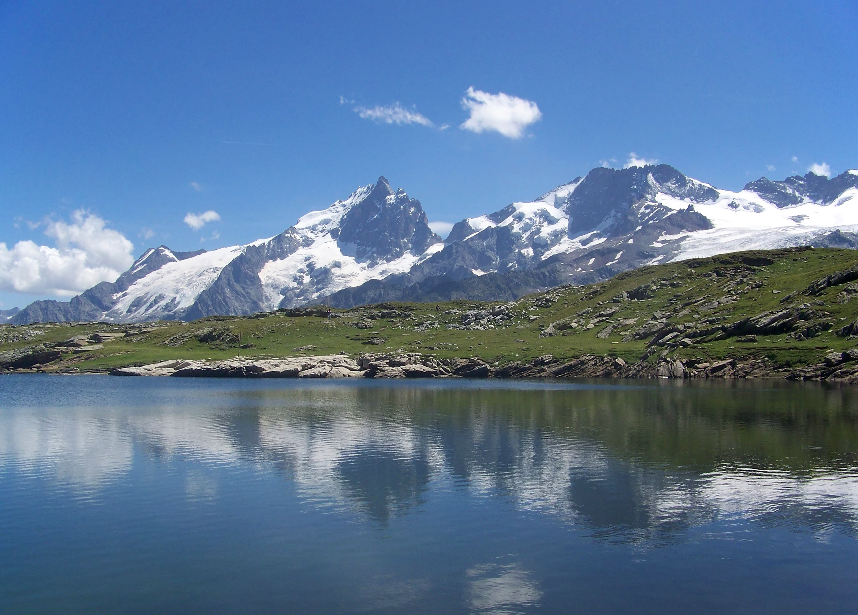
English: La Meije massif from Lac Noir, on the Emparis plateau (French Alps). In the background, from the left: Tabuchet Glacier, Grand Pic de la Meije (main summit on the picture) and Meije glacier, Râteau glacier, le Râteau (wider summit), Girose glacier.
Français : Le massif de la Meije depuis le Lac Noir, sur le plateau d'Emparis (Alpes françaises). À l'arrière-plan, de gauche à droite : le glacier du Tabuchet, le Grand Pic de la Meije (sommet principal sur la photo) et le glacier de la Meije, le glacier du Râteau, le Râteau (sommet plus large), glacier de la Girose. |
|
| Թվական | ||
| Աղբյուր | Բեռնողի սեփական աշխատանք | |
| Հեղինակ |
| |
| Հղում (required by the license) | © Guillaume Piolle / | |
| Տեսախցիկի տեղագրություն | | Այս և ուրիշ պատկերներ իրենց տեղագրությամբ OpenStreetMap |
|---|
| Annotations | This image is annotated: View the annotations at Commons |
|


|
This image has been assessed under the valued image criteria and is considered the most valued image on Commons within the scope: Lac Lérié. You can see its nomination here. |
Արտոնագրում
Ես, այս աշխատանքի հեղինակային իրավունքների տերը, ներկա հրատարակում եմ սրա հետևյալ լիցենզիաների պայմաններով

|
Այս վավերագրման պատճենահանման, տարածման և/կամ ձևափոխման թույլտվություն կամ լիցենզիայի GNU FDL պայմաններով 1.2 մեկնակերպի կամ ավելի ուշ, հրատարակված Ազատ ծրագրային ապահովության հիմնադրամում, առանց անփոփոխելի հատվածների, առանց բնագիրների, որոնք տեղադրված են առաջին և վերջին շապիկներում: Լիցենզիայի պատճենը գտնվում է GNU Free Documentation License հատվածում: |
This file is licensed under the Creative Commons Attribution 3.0 Unported license.
- Դուք ազատ եք՝
- կիսվել ստեղծագործությամբ – պատճենել, տարածել և փոխանցել այս աշխատանքը։
- վերափոխել – ադապտացնել աշխատանքը
- Պահպանելով հետևյալ պայմանները'
- հղում – Դուք պետք է նշեք հեղինակի (իրավատիրոջ) հղումը:
Կարող եք ընտրել այս թույլատրագրերից ցանկացածը։
Նիշքի պատմություն
Մատնահարեք օրվան/ժամին՝ նիշքի այդ պահին տեսքը դիտելու համար։
| Օր/Ժամ | Մանրապատկեր | Օբյեկտի չափը | Մասնակից | Մեկնաբանություն | |
|---|---|---|---|---|---|
| ընթացիկ | 06:26, 4 Սեպտեմբերի 2008 | | 2976 × 2135 (2,36 ՄԲ) | Eusebius | |
| 18:04, 1 Սեպտեմբերի 2008 |  | 2976 × 2135 (3,08 ՄԲ) | Eusebius | {{Information |Description={{en|1=La Meije massif from Lac Lérié, on the Emparis plateau (French Alps). In the background, from the left: Tabuchet Glacier, Grand Pic de la Meije (main summit on the picture) and Meije glacier, Râteau glacier, le Râteau |
Նիշքի օգտագործում
Հետևյալ էջը հղվում է այս նիշքին՝
Նիշքի համընդհանուր օգտագործում
Հետևյալ այլ վիքիները օգտագործում են այս նիշքը՝
- Օգտագործումը ar.wikipedia.org կայքում
- Օգտագործումը az.wikipedia.org կայքում
- Օգտագործումը da.wikipedia.org կայքում
- Օգտագործումը de.wikipedia.org կայքում
- Օգտագործումը en.wikipedia.org կայքում
- Օգտագործումը fi.wikipedia.org կայքում
- Օգտագործումը fr.wikipedia.org կայքում
- Օգտագործումը hak.wikipedia.org կայքում
- Օգտագործումը it.wikipedia.org կայքում
- Օգտագործումը mk.wikipedia.org կայքում
- Օգտագործումը no.wikipedia.org կայքում
- Օգտագործումը os.wikipedia.org կայքում
- Օգտագործումը pl.wikivoyage.org կայքում