Պատկեր:British Empire 1921 IndianSubcontinent.png
Նախադիտման չափ՝ 800 × 351 պիքսել։ Այլ թույլտվությաններ: 320 × 140 պիքսել | 640 × 281 պիքսել | 1425 × 625 պիքսել.
Սկզբնական նիշք (1425 × 625 փիքսել, նիշքի չափը՝ 39 ԿԲ, MIME-տեսակը՝ image/png)
Ամփոփում
| Նկարագրում |
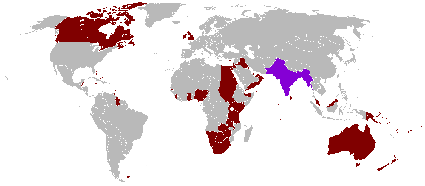
English: A map of the British Empire in 1921 when it was at its height with British India indicated when it too was at its height as well. |
||
| Թվական | Uploaded on 27 Օգոստոս 2008, 21:41. | ||
| Աղբյուր | Բեռնողի սեփական աշխատանք | ||
| Հեղինակ | Vadac. | ||
| Իրավունքներ (Նիշքի վերաօգտագործումը) |
|
||
| Այլ մեկնակերպներ | File:British Empire 1921.png, File:British and French empires 1920.png |

|
This historical map image could be re-created using vector graphics as an SVG file. This has several advantages; see Commons:Media for cleanup for more information. If an SVG form of this image is available, please upload it and afterwards replace this template with
{{vector version available|new image name}}.
It is recommended to name the SVG file “British Empire 1921 IndianSubcontinent.svg”—then the template Vector version available (or Vva) does not need the new image name parameter. |
Նիշքի պատմություն
Մատնահարեք օրվան/ժամին՝ նիշքի այդ պահին տեսքը դիտելու համար։
| Օր/Ժամ | Մանրապատկեր | Օբյեկտի չափը | Մասնակից | Մեկնաբանություն | |
|---|---|---|---|---|---|
| ընթացիկ | 07:59, 31 Հոկտեմբերի 2021 | | 1425 × 625 (39 ԿԲ) | Randomastwritter | . |
| 22:25, 13 Օգոստոսի 2016 |  | 1425 × 625 (39 ԿԲ) | RickoTroanman22 | Tibet re-added | |
| 18:58, 7 Մայիսի 2011 |  | 1425 × 625 (50 ԿԲ) | Quigley | Correct China's borders closer to what was internationally recognized at the time | |
| 01:42, 13 Հոկտեմբերի 2010 |  | 1425 × 625 (50 ԿԲ) | Vadac | Aden was not part of the British Raj. Matched map to File:British Empire 1921.png | |
| 18:03, 11 հունվարի 2006 |  | 1345 × 614 (28 ԿԲ) | Miljoshi | More Changes as per w:Talk:British Raj. | |
| 10:21, 9 հունվարի 2006 |  | 1345 × 614 (28 ԿԲ) | Miljoshi | Correcting wrong inclusion of Nicaragua - w:User:Big Adamsky | |
| 11:51, 6 հունվարի 2006 |  | 1345 × 614 (22 ԿԲ) | Miljoshi | Discounting Sri Lanka | |
| 10:30, 6 հունվարի 2006 |  | 1345 × 614 (22 ԿԲ) | Miljoshi | Updated map with corrections in Aden, Lebanon, Nicaragua, New Caledonia, Goa, Daman, Pondycherri. | |
| 17:01, 5 հունվարի 2006 |  | 1345 × 614 (23 ԿԲ) | Miljoshi | British Empire in 1921 - Indian subcontinent is highlighted in purple. Image based on GFDL Image:British Empire 1921.png by w:Arthur Wellesley |
Նիշքի օգտագործում
Հետևյալ 2 էջերը հղվում են այս նիշքին՝
Նիշքի համընդհանուր օգտագործում
Հետևյալ այլ վիքիները օգտագործում են այս նիշքը՝
- Օգտագործումը af.wikipedia.org կայքում
- Օգտագործումը bg.wikipedia.org կայքում
- Օգտագործումը da.wikipedia.org կայքում
- Օգտագործումը de.wikipedia.org կայքում
- Օգտագործումը en.wikipedia.org կայքում
- Օգտագործումը es.wikipedia.org կայքում
- Օգտագործումը id.wikipedia.org կայքում
- Օգտագործումը kk.wikipedia.org կայքում
- Օգտագործումը kn.wikipedia.org կայքում
- Օգտագործումը ml.wikipedia.org կայքում
- Օգտագործումը nl.wikipedia.org կայքում
- Օգտագործումը nn.wikipedia.org կայքում
- Օգտագործումը no.wikipedia.org կայքում
- Օգտագործումը ru.wikipedia.org կայքում
- Օգտագործումը tum.wikipedia.org կայքում
- Օգտագործումը uz.wikipedia.org կայքում
- Օգտագործումը vep.wikipedia.org կայքում